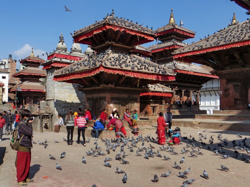
I have been dreaming about Annapurna trek for several years. I read many reviews and stories and finally I decided to go there at the end of February at the very beginning of high season. This was my biggest fault, but how I could know that the weather will be so unstable… I read several stories about trekking around Annapurna even in December and the main problem was only the very cold weather. Every story told that sometimes due to the snowfalls Thorung La pass can be closed for several days,but there is always a path even in the hardest months….
I read a lot that there are many tourist on the trek during high seasons. Paths are overcrowded, hotels are full and as a result the impression of the mountain’s beauty is spoiled…That is why I choose the end of the February.
Looking ahead I should admit that we have not done this trek. We reached Manang where we had to come back due to the heavy snowfalls that close Thorung La pass for indefinite period of time. But still I want to share my experience of our trek around Annapurna with you. Hope it will be useful for those who are going to visit Annapurna at this period.
All useful information you might want to know when planning this trek I wrote in the very detailed travel guide about Annapurna circuit. I don’t want to advise you anything just say that next time I would choose September or November for trekking. I have no regrets, it was great experience and adventure. I have never seen too much snow! There were few tourists on the trek. Hotels were empty and we met only several travelers during the day.
Contents:
- Day 1: Pokhara (800m) - Besisahar (820m) - Bhulbhule (840m) - Bahundanda (1310m)
- Day 2: Bahundanda (1310m) - Ghermu (1130m) - Jagat (1300m)
- Day 3: Jagat(1300m) - Tal (1700) - Dharapani (1900m)
- Day 4: Dharapani (1900m) - Danaque (2220m) - Chame (2710m)
- Day 5: Chame (2710m) - Bhratang (2850m) - Dhukur Pokhari (3240m) - Upper Pisang (3310m)
- Day 6: Upper Pisang (3310m) - Humde (3330m)
- Day 7: Humde
- Day 8: Humde (3330m) - Bhraka (3450m) - Manang (3540m)
- Day 9: Manang (3540m) - Lower Pisang (3200m)
- Day 10: Lower Pisang (3200m) - Chame (2710m)
Day 1 (24 February, 2015)
Pokhara (800m) - Besisahar (820m) - Bhulbhule (840m) - Bahundanda (1310m)
Walking distance: 8km, 4 hours
The day before we bought a ticket from Pokhara to Besisahar for the “tourist” bus. Buying tickets in Nepal from travel agencies is usually a little bit challenging. Neither number of the bus nor name of the company didn’t match, but the bus was there and driver was satisfied with our tickets so we jump into bus and waiting for departure.
Tourist buses to Besisahar departs daily from tourist bus station around 6.30am
It took about 4 hours and a half to get to Besisahar. So around 11 am we stood in front of TIMS office where driver dropped us off. We registered in TIMS office (show our TIMS cards)
Then we found ticket counter not far away from TIMS office to figure out about jeeps and buses to Bhulbhule. As i already wrote here prices were as follow:
jeep to chame (7-8 travel hours): 2000 Rupee (20$)
jeep to jagat (4-5 travel hours): 1000 Rupee
bus to Bhulbhule (1.5 hour): 200 Rupee
We decided to go to Bhulbhule by bus, bought tickets and began to wait. Bus came in 20 minutes full of Nepalese people and their staff. I hardly found a sitting place for me, my friend sat down on the floor as it was hard to stand their - Nepalese buses are very low.
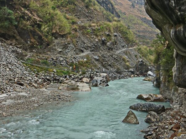
We got off the bus in the Bhulbhule near suspension bridge. We crossed the bridge to get to the west bank of the river where there was a path without jeeps. Just after the bridge we had a lunch and continued walking. Day was nice and warm in spite of some clouds. It was very unusual and rather hard to walk in my heavy boots.
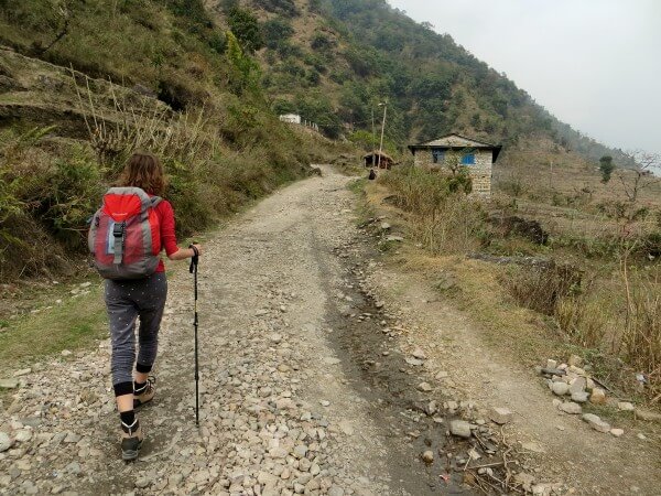
We crossed another bridge near Lampata to return to the east bank because we intended to live in the Bahundanda village. We were tired and we lost among rice terraces near Lampata. It was steep ascend just after the bridge and after it the path became not so obvious. But finally after several ascends and descends we reach a path and moved to Bahundada. Definitely, the way on the road for jeep would not be so demanding but we have a nice walk, anyway.
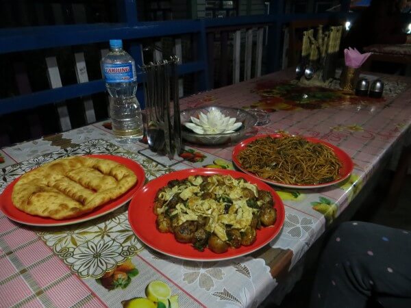
Finally, we got to the suburbs of the Bahundanda and exhausted we settled down at first hotel Kalika. It has pretty balcony with a view, common very simple room and no hot water in the shower - it was a big surprise. Water was like in the cold cold mountain river, but after hard warm day I somehow forced myself to wash away the sweat. We had a good dinner of soup, tibetan bread and plate of fried potatoes.
Day 2 (25 February, 2015)
Bahundanda (1310m) - Ghermu (1130m) - Jagat (1300m)
Walking distance: 9 km - 6,5h
This day we went slowly, I assume that was due to my heavy shoes. It was warm but cloudy day. First we reached center of Bahundada village where many hotels and guesthouses are situated.
There are shops and pharmacy as well. Then we continued to Ghermu. Road was going up and down, but it is very picturesque, along the river in the canyon with houses scattered on the mountain slopes.
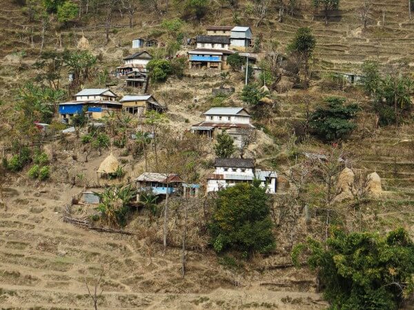
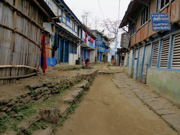
It took around 2.5 hours to get to the next village - Ghermu. Ghermu is rather big village with beautiful lodges that offer wifi. There are shops, and even tailor with a sewing machine. We saw how some women using strange attachment made a thread of the wool, while other wove the carpets.
After Ghermu we got to Syange where we crossed the bridge. Walking path and road for jeeps merge here. There are around 10 lodges and several restaurants in Syange. Then after Syange there is quite steep ascend to Jagat.
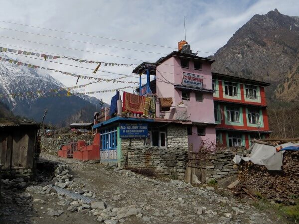
In Jagat we chose hotel Mont Blanc in the beginning of the village. It offers working free wifi and warm shower. There was a socket in the room, food was tasty and serving was big!
Day 3 (26 February, 2015)
Jagat (1300m) - Tal (1700) - Dharapani (1900m)
Walking distance: 15.6 km - 6.5h
When we woke up around 8am there was raining… We laid down under warm blankets and can’t force ourselves to get up. Finally around 9am rain stopped, I boiled water and made a tea, suggesting my friend to go further but he didn’t hurry to go out… Soon it appeared to be quite the wisdom decision to wait because in half an hour rain started with a bang... So we waited for an hour or more when the rain stopped again. This time we packed our backpacks quickly and continued our trip.
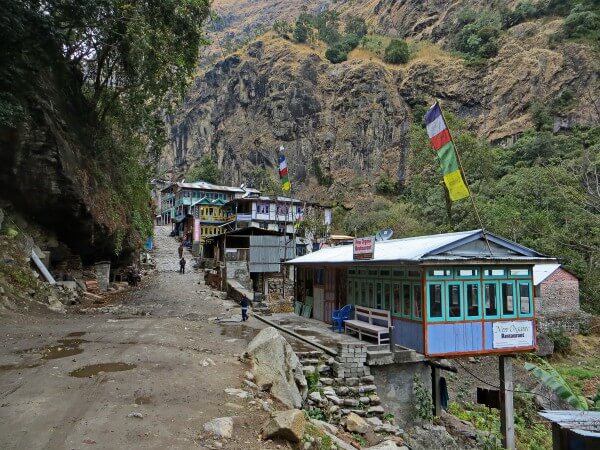
From Jagat to Tal path is going up and down but it is easy and very nice. If you want you may choose the road for jeeps, it is much more sloping and easy for trekking. There is a new bridge just before Tal so it is easy to get from one side of the river to another.
Tal is a big beautiful village with around 20 guesthouses. There is a water refill for the price of 40 Rupee per liter.
First we thought we would spend night in Tal, but we reached it quickly and we felt the energy to continue so we decided to go to Dharapani. After Tal strong wind arose and a rain began. Soon I saw a small hut that looked like shed. I thought it would be nice to wait out the rain, that just even strengthened. I came into the hut and saw three women sitting around the fire and boiling a big pot of water. There were a table and benches in the hut as well. We sat down and ask for a cup of hot water. Soon we drank a tea, eat a snickers and observe the rain. When the rain began to fall slightly we move further.
Road from Tal to Dharapani is simple, it took around 2.5 hour for us to reach Dharapani (with a stop for a tea). There are about 15 guesthouses in Dharapani. We eventually passed the village and found ourselves on the suburb of the village where there were only 2 guesthouses. We settled down in the Green Park Guesthouse. There was a gas shower, that appeared more cold than warm because of the very cold water and weak gas supply. There was no socket in the room and we charged the phone in the dining hall. where we boiled the water for the tea as well. Food was good and serving were big. It became cold at night. We slept under 2 warm blankets without sleeping bag.
Day 4 (27 February, 2015)
Dharapani (1900m) - Danaque (2220m) - Chame (2710m)
Walking distance: 15 km - 5h
Hooray, it was sun in the morning and we can see the mountains from our room.
First we reached village Danaque in around 2 hours. Road is easy and slopping. Danaque is a big village with police checkpost, water refill and around 15 lodges that offer wifi and promise gas hot shower.
After Danaque we continued to go by jeep road but then after it crossed the river I advise you to use a steep but picturesque and shorter path. It is marked with white-red label on the big stone at the beginning of the path. Path itself is made of stones and is almost like steps.
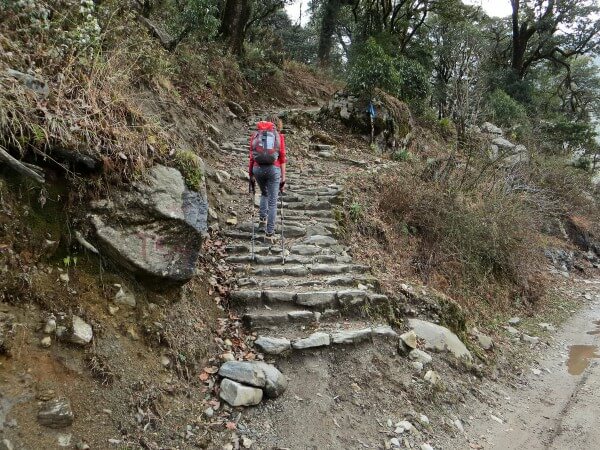
You will probably be tired at the end but it is better than use a jeep road. And as an encouragement for difficult ascend you will find a very beautiful village of Timang.
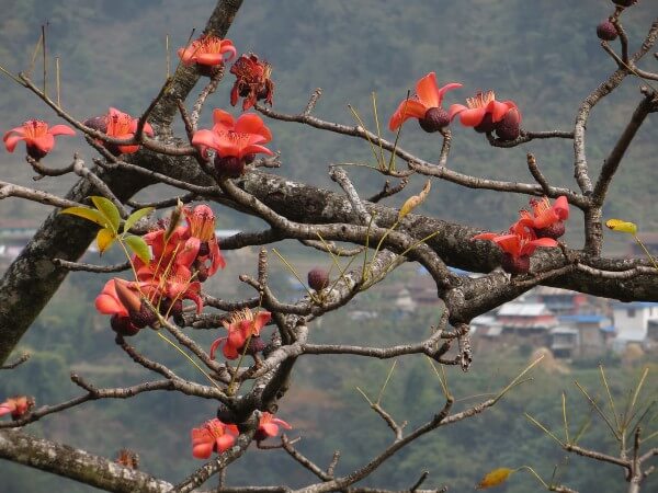
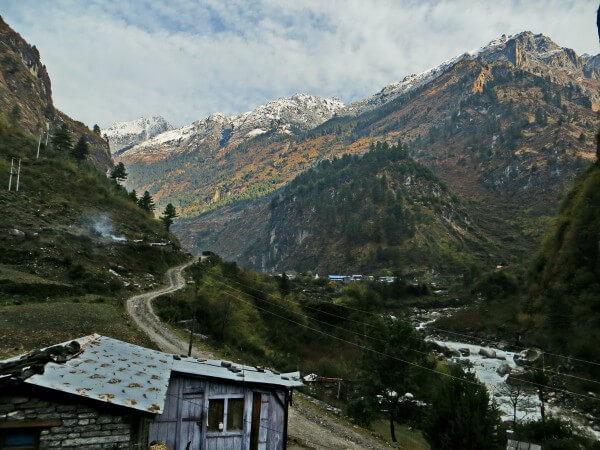
We consider Timang one of the most picturesque village on the route. It is situated in the valley surrounded by snow-capped mountains.The weather was perfect, we sat down on the roof of the restaurant, drank hot tea and life seems to be fantastic.
Not so long ago Timang was a small village of several houses, but now it develops quickly and you can find around 10 beautiful guesthouses there.
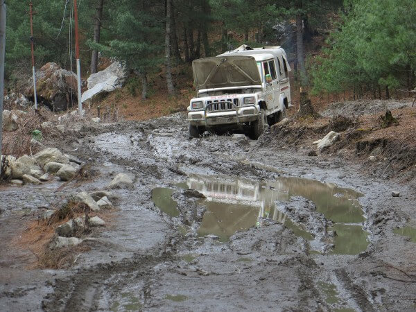
After Timang road follows to Chame. It is easy, with several moderate ascends and descends. But due to the rains, road was absolutely muddy and we saw one jeep that was stuck in that mud.
First we reached a Koto, a village with about 10 guesthouses. And after 20 minutes we came to Chame.
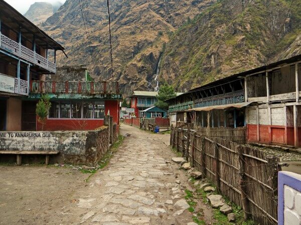
Chame is a huge village comparing to others.There are about 20 guesthouses, many shops that sell you everything you might need (even clothes for trekking). There is also a bank, post and water refill station (45 Rupee for a litre of water).
We lived in the New Tibet Guesthouse at the end of the village just after the bridge. It is a nice red building from the outside, but room was unpleasant. However, we were tired, rain began to fall and we didn’t want to came back for searching the better place. Moreover, owner of the guesthouse gave us this room for free on the condition that we will be eating in his restaurant.
Good point of the guesthouse was its warm dining hall with a fireplace. The hotel was full and everybody ate dal bhat so we decided to try this traditional meal. As i already mentioned in this guide we didn’t like dal bhat and decided not to order it anymore. After dinner we sat for a while in the warm dining hall and then went to sleep in our cold-cold room.
Day 5 (28 February, 2015)
Chame (2710m) - Bhratang (2850m) - Dhukur Pokhari (3240m) - Upper Pisang (3310m)
Walking distance: 14 km - 6h
From Chame to Bhratang the road is easy, it took around 3h to get there. There is only one guesthouse and restaurant in Bhratang where you might want to stop for lunch and rest.
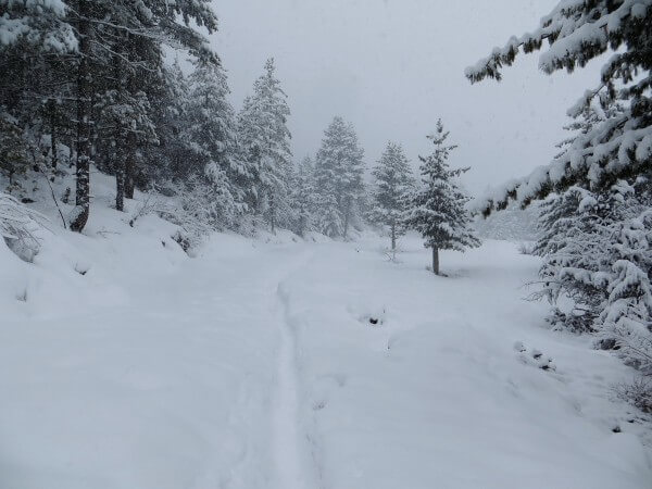
After Bhratang, first part of the road is sloping but after you cross the bridge long tiresome ascend begins. Road passes through beautiful pine wood forest that reminded me Ukraine. Here the snow began.
Eventually, after about 2 hours we reached Dhukur Pokhari with about 10 lodges and restaurants most of which were closed - everything pointed to season have just began….. Thus some of the restaurants were opened and we stopped to have a snack with hot tea and cookies.
After Dhukur Pokhari we follow the road to Upper Pisang with moderate ascend. It took us about 1 hour to get to Upper Pisang. Sky was full of grey clouds and it was quite obvious that snow is coming soon…
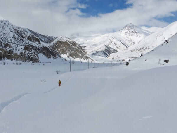
This day all along the path we met many people who came back from Manang. I asked some of them why did they come back. The answer was the only one - there is too much snow on the Thorung La pass, it will be closed for … days…. No optimistic forecasts, people are tired to wait or have no more time.
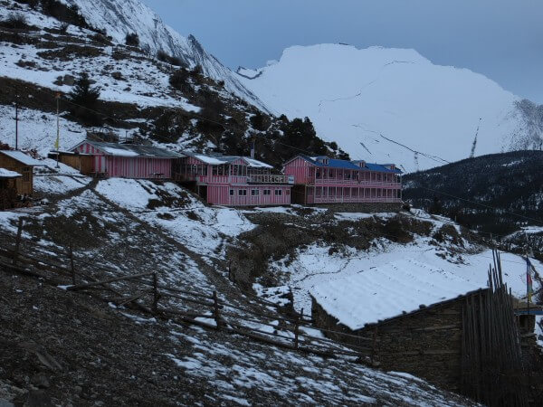
In Upper Pisang we settled down in the pink nice guesthouse Hill Top Superview. If the weather was fine we would probably saw the Annapurna from our window, but….
Food was good, there was a fireplace in the dining hall as well where everybody try to dry their wet socks, boots and frozen body. Another benefits of the guesthouse was socket in the room and free working wifi.
As we reached Upper Pisang around 15 oclock, we got a cup of tea and decided to have a walk around the village. Upper Pisang consists of old houses, it is very picturesque village. We climbed up to the top of the monastery. It was cold in the evening and we slept under 2 blankets and in the sleeping bag.
Day 6 (01 March, 2015)
Upper Pisang (3310m) - Humde (3330m)
Walking distance: 7.5 km - 4,5 h
It was heavy snowfall in the morning. We were confused what to do next. Whether we should stay in the hotel and wait until tomorrow, or it is better to move further (as forecasts predict even more snow for tomorrow). In the guesthouse we got acquainted with 4 young germans and they were ready to move to Manang, so did we….
There are two roads to Manang from Pisang. One ‘lower’ road is easy and sloping, it goes along airport and is not as picturesque as another one.
Other ‘upper’ road is rather demanding, it has hard ascends to the village Ngawal where tourists usually spend the night before reaching Manang on the second day.
We read a lot about these two roads and we planned to choose the upper one because of it promising beautiful scenery and mountains view. But today snowfall spoiled all our plans. Upper road was totally hidden by snow and we hardly made a descend to Lower Pisang by long staircase and moved towards Manang by “lower” easy road….
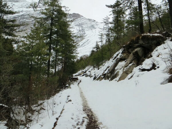
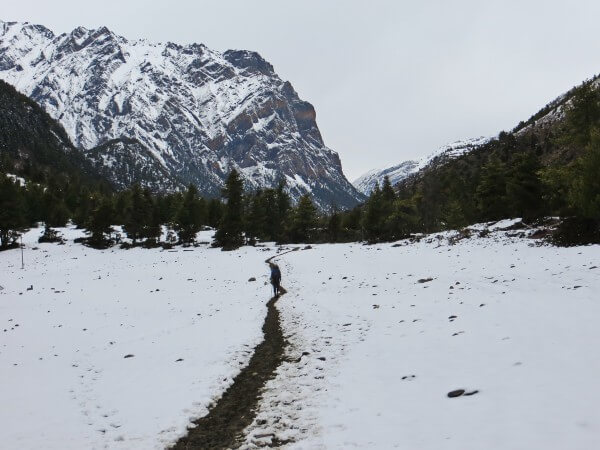
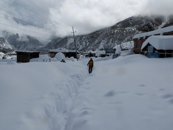
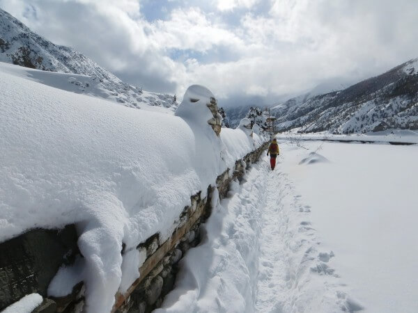
But it appeared to be not as easy as promised. One of the easiest day of the trekking was one of the hardest for us. There were a lot of snow and path was hardly recognizable. My jacket got wet rather quickly and my fleece jacket became wet too and it was very unpleasant feeling. It was cold to move in wet clothes, furthermore snow was poured over the top of the boots because we didn’t take our snow gaiters with us and the level of the snow on the path was high enough (sometimes up to the knee).
Moreover, there are no villages nor teahouses up to Humde… So we did that seven and a half kilometers for four and a half hours without any rest… If it were sun and warm it could be probably really easy walking… Again we met some people who were frightened by the snow and advised us to come back due to no path available. But we continued to move further…
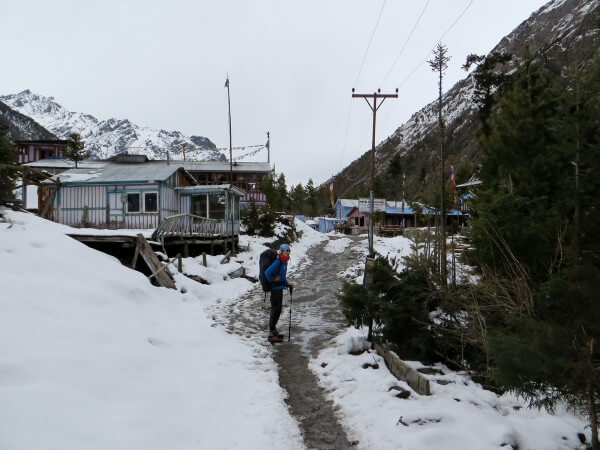
So when we finally reached Humde, which is in the midst between Lower Pisang and Manang, my friend and I realized that there is no chance for us to go up to Manang today. We were fully exhausted by the snow and cold and one our desire was to take off all the wet clothes and to keep warm somehow.
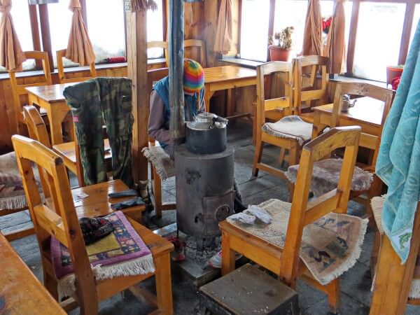
Many guesthouses and restaurants in Humde were closed and I was frightened that we didn’t find any shelter. But eventually we saw Mary Lodge Guesthouse that was opened. The room was very simple, there were no socket in it and of course no wifi in house, but it didn’t matter. There was a small fireplace in the dining hall and hostess promised to make a fire. So we made the decision to stay there.
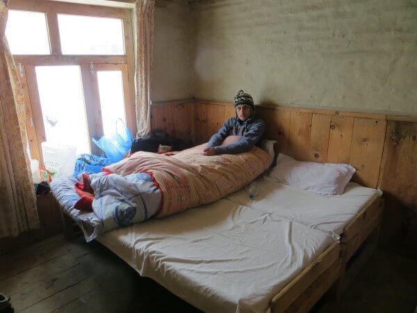
We took off all our wet clothes and hang on the backs of the chairs around the fireplace. Although, we bought a cup of hot water and made a wonderful lemon tea…We spent day near the fireplace, when in the evening the group of eight nepalese people came in to our guesthouses. They joined us and we sat together around the fireplace. It was a group of people that go to Manang to work in the hotel.
Dinner was tasty but meagre in comparison with our previous hotels. There were no running water in the guesthouse due to the cold weather.It was cold to sleep but again two blankets and sleeping bag helped a lot.
Day 7 (02 March, 2015)
Humde
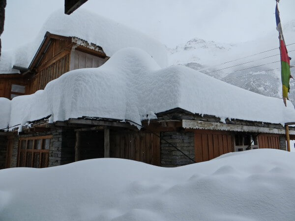
All night long snow fell down and in the morning everything was covered with huge snow layer. In the morning snow didn’t stop and it was obvious that we should stay in Mary Lodge for at least one more day as there were no paths anymore.
Nepalese people who came yesterday evening helped hostess to sweep the snow from the roof. Fireplace in the dining hall was not kept, it was cold there and we sat down in our room under two blankets. I was sleeping and when I woke up I finally felt that now I got enough sleep over the last few weeks. Then we read the books. It was hard enough to spend whole day in cold house, without electricity and wifi.
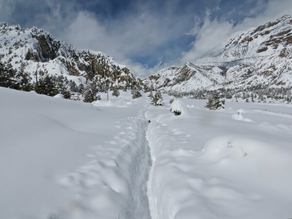
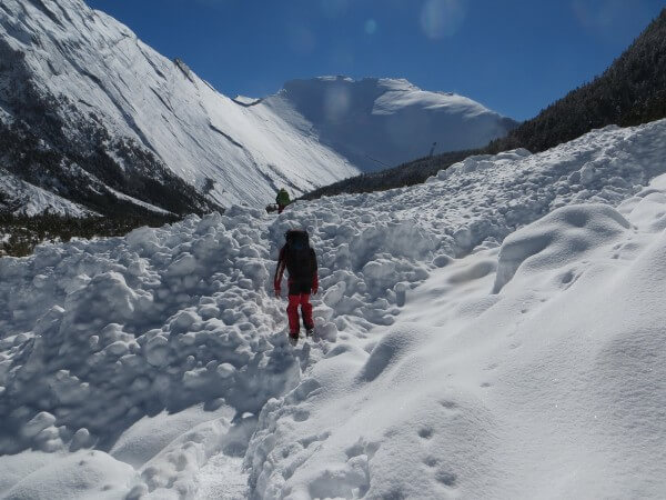
At the afternoon snow stopped. My friend went out to try to made the way in the snow, he was curious about this. He came back in half an hour and told that snow sometimes is above his chest. He made about 300 meters of road, swimming in the snow and was very tired.
At nightfall we heard knocking at the door. Group of tourists with guide and porters came from Manang. It was very unexpectedly, but it was a good sign. All tourists were english-speaking, there were canadians, australians and scotlands among them. They told us that there were no path from Manang to Humde and they made the way in snow all day long for 12 hours together with their guide and porters. They looked very tired. Thanks to them hostess perked up and made a fireplace. It was nice to sit around hot stove by the candlelight.
Nepalese guide told us there is no path to Thorung La as well. “Thorung Pass will be closed for at least ten days” - he said - “That’s why my group and me came back now”.
After dinner we went to sleep with a dim hope to reach Manang tomorrow by the path tourists made today….
Day 8 (03 March, 2015)
Humde (3330m) - Bhraka (3450m) - Manang (3540m)
Walking distance: 6 km - 3h
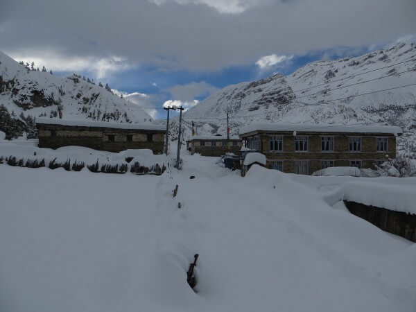
It was snowing again in the morning. This time it was not so heavy like previous days and around 10 am sun came out from the clouds. It was hard for us to decide in which direction to go. We may go further to Manang using the narrow path made by tourists, or we may wait for tourists until they move back to Pisang as there was no path after snowfalls.
Finally we realized that we don’t want to wait and sit in the Mary Lodge anymore and began to walk to Manang. Path was obvious enough, it looked like a tunnel in snow with a snow level sometimes above my waist. It was quite easy to follow the beaten track, but I was still tired.
We reached the village of Mungje in 2 hours and stopped to have a break and drink tea. Mungje is a small village with several restaurants and guesthouses.In about 20 minutes from Mungje there is a village of Bhraka - bigger than Mungje but still rather small (there are 4 guesthouses in the Bhraka).
Snow has melted and there was water on the path. My friend decided to bypass this part of road, but I went through the puddles and fully wet feet. The icy water burst into the shoes, I was lucky it was only 40 minutes from Manang.
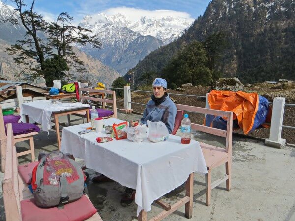
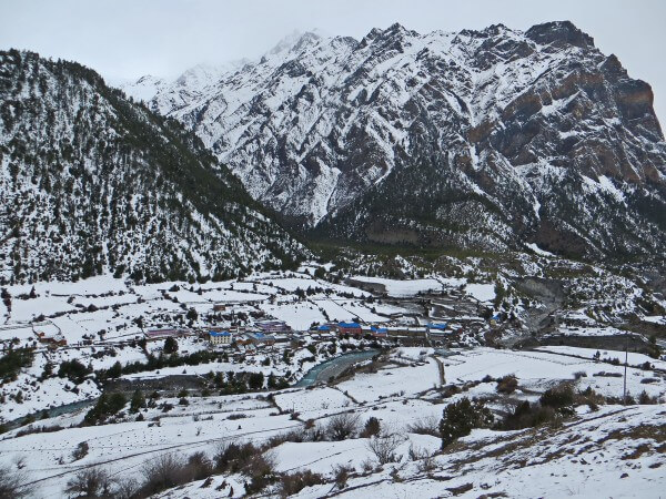
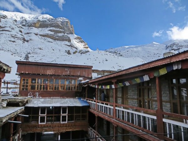
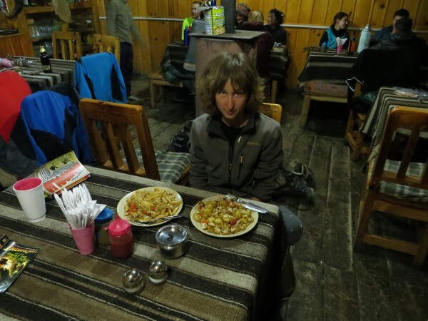
Despite the fact that Manang is the biggest city in this district, life was not in full swing there. Many shops, restaurants and hotels were still closed, I think due to the snowfalls. We choose the hotel Tilicho. It is very nice hotel, with warm and cosy dining hall, big stove and friendly atmosphere. Food was rather expensive there, but we didn’t check prices in other hotels, so maybe they are the same in all hotels in Manang as well as on the whole trek. One guy told us he ate in the nearby restaurant for a cheaper price. Charging costs 100 Rupee and wifi is 200 Rupee per day.
We ordered two buckets of warm water (for 200 Rupee each) to get a shower and I washed my head! We spent evening in the dining hall together with other tourists, eating our tasty dinner and good chocolate cake. The atmosphere there didn’t look like in the mountains, it was similar to that one on the seaside. Everybody was relaxed, drank beer chatting with each other.
All tourists were stuck here in hesitation. There were no forecasts when Thorung La will be opened for passing. Everything depends on very unstable weather. One girl told her friends and she were trying to make a pass to Yak Kharka today, but it seemed impossible. It is very hard, they spend a couple of hours swimming and falling in the snow and made only 1 km of path. They gave up. So did we. We decided to came back. It was hard for us just sitting here and waiting without any certainty.But still some guys were ready to wait and make a path day by day...
It was the most cold night during our trip. Water froze in the bucket, so the temperature in the room was below zero.
Note: if you are more lucky than we and you are going to pass the Thorung La, be ready to spent at least 2 days in Manang for acclimatization. Also, keep in mind that you shouldn’t ascend more than 500 meters per day after 3000 meters altitude.
Day 9 (04 March, 2015)
Manang (3540m) - Lower Pisang (3200m)
Walking distance: 15 km - 8.5h
It was rather hard day and at the end we were tired and exhausted, all because of snow. There was a narrow path in the snow but it was difficult to move.
We went slowly. It was sun in the morning, but after we had a rest in Humde snow began to fall and clouds covered the sky. It got cold immediately without sun.
It took us around 4.5 hours to get from Manang to Humde with two stops in Mungje and Humde for a rest and tea. And then 4 hours from Humde to Pisang without any rest as there are no villages and teahouses on the way.
Finally, we reached Lower Pisang. There were no light in village. We settled down in the hotel Tilicho. Room was as usual. There was dining hall where we sat down around the stove and had a warm with other tourists. Food was middling.
Day 10 (05 March, 2015)
Lower Pisang (3200m) - Chame (2710m)
Walking distance: 15 km - 7.5h
Path to Bhratang was full of snow. We saw many traces of avalanches, they damaged a lot of trees. Some of avalanches reached hundreds of meters wide.
There was sunny day and the sky was clear. We even saw Annapurna II from Pisang. We had a rest and a cup of tea in Dhukur Pokhari. There was a noticeable revival, many restaurants and guesthouses were preparing to be opened soon.
In the only restaurant in Bhratang we have a lunch and saw the helicopter.
We reached Chame rather early, around 3 pm. We decided to go by jeep to Besi Sahar next morning, so it was no sense to go further as all jeeps start in Chame and it is easier to catch it there.
This time we settled down in the hotel Sanjo next to New Tibet. The hostess was nice tibetan woman who said us she will go by jeep to Besisahar tomorrow with us and help us to arrange the trip.
We had a dinner in the dining hall together with nepalese people who also lived in the hotel. They went to Chame for some reason, all of them were teachers and had a job in the private school. It was interesting to speak to them.
Hostess promised us that jeep will come at 6 am tomorrow.
Day 11 (06 March, 2015)
Chame (2710) - Besisahar
We woke up early in the morning to pack our backpacks and had a breakfast together with a hostess. Jeep came only at 7 am after hostess sent her son to wake up the driver. We were lucky to have a sit in front seats near the driver.
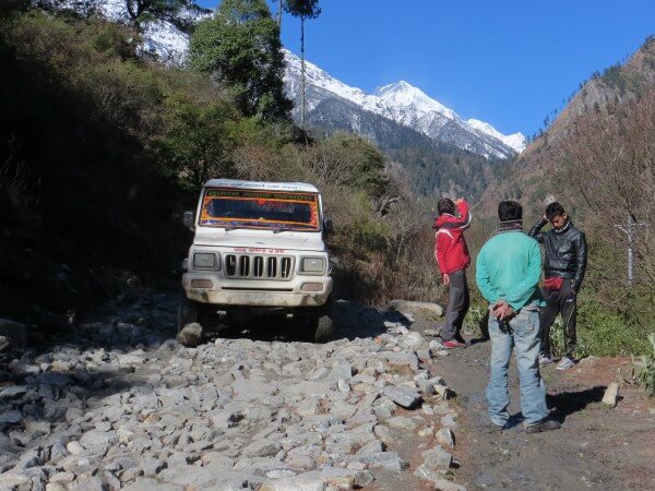
Distance between Chame and Besisahar is 33 km and it took 6 hours to overcome this distance as the road is very poor. We reached Besisahar around 2 pm.
We wanted to get to Pokhara on the same day and found the minibus that should depart in an hour. But eventually when we sat down and began our trip minibus broke down… So we spend one night in Besisahar (there are several hotels in Besisahar). In the morning we caught the bus to Dumre and from Dumre the minibus to Pokhara.